RYA-tips #20 – Offshore cruising, how to keep updated on the weather?
Zeilen is een combinatie van wetenschap en kunst. En voor wie daar meer over wilt weten schrijft Albert De Nijs, instructeur bij de De Zeezeilers van Marken wekelijks een rubriek met tips&trics van de Royal Yachting Association.
While still ashore there is a wealth of information available via internet. When coast-hopping you could be within mobile internet range, and be able to update your weather information. Further offshore you will have to rely on VHF broadcast and Navtex.
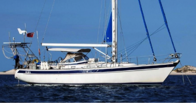
Another option is to switch to long-range communication systems, which is also the way to go when sailing more then 150 nm offshore (approx. range of Navtex).
For blue water sailors the ‘standard’ option used to be an SSB radio combined with a Pactor modem. This allows you to receive weather charts, GRIB files etcetera. These radios work on HF transmissions, the installation is tricky and finding a workable frequency requires some experience and patience. HF-radio is quite often used for easy (free) communication between yachts (cruiser radio nets).
The other option is satellite communication. The last few years there has been a big leap in this technology. There are more operators, providing better coverage, offering lower prices and easier to install equipment. Nowadays there are smart boxes that manage the satellite connection with a simple antenna, and allow you to log on to that system with your laptop or iPad. Even unlimited data contracts are available, although still at a limited download speed. Participants in last year’s ARC show a clear preference for the satellite option.
Both HF-radio and satellite systems provide long-range communication, which can of course be used in many different ways. You can send a request for specific weather information, for example a weather chart or GRIB files for your region. The data is collected, compressed and send back to you.
As we discussed in previous articles, a good understanding of the weather situation in your area is essential. These options allow you to access basic weather information, which for me would be synoptic + forecast weather charts, GRIB files and GMDSS info (Area forecast + warnings). There is overlap in these data, but that would allow you to build your own picture. Easy communication also allows back-office support, a shore-contact could send you weather information and routing advice.
These high-end options have definitely made crossing oceans safer, but also changed the charm and character of the adventure. On the low-tech side we will always have the trustworthy barometer to warn us for change in the weather!
Albert de Nijs, Dutch Offshore Sailing Academy