RYA-tips #24 – Passage planning – a structured way to create overview
Zeilen is een combinatie van wetenschap en kunst. En voor wie daar meer over wilt weten schrijft Albert De Nijs, instructeur bij de De Zeezeilers van Marken wekelijks een rubriek met tips&trics van de Royal Yachting Association.
In a recent article we discussed weather planning. This fits nicely within the broader subject of passage planning.
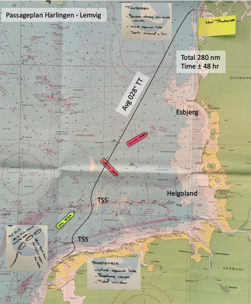
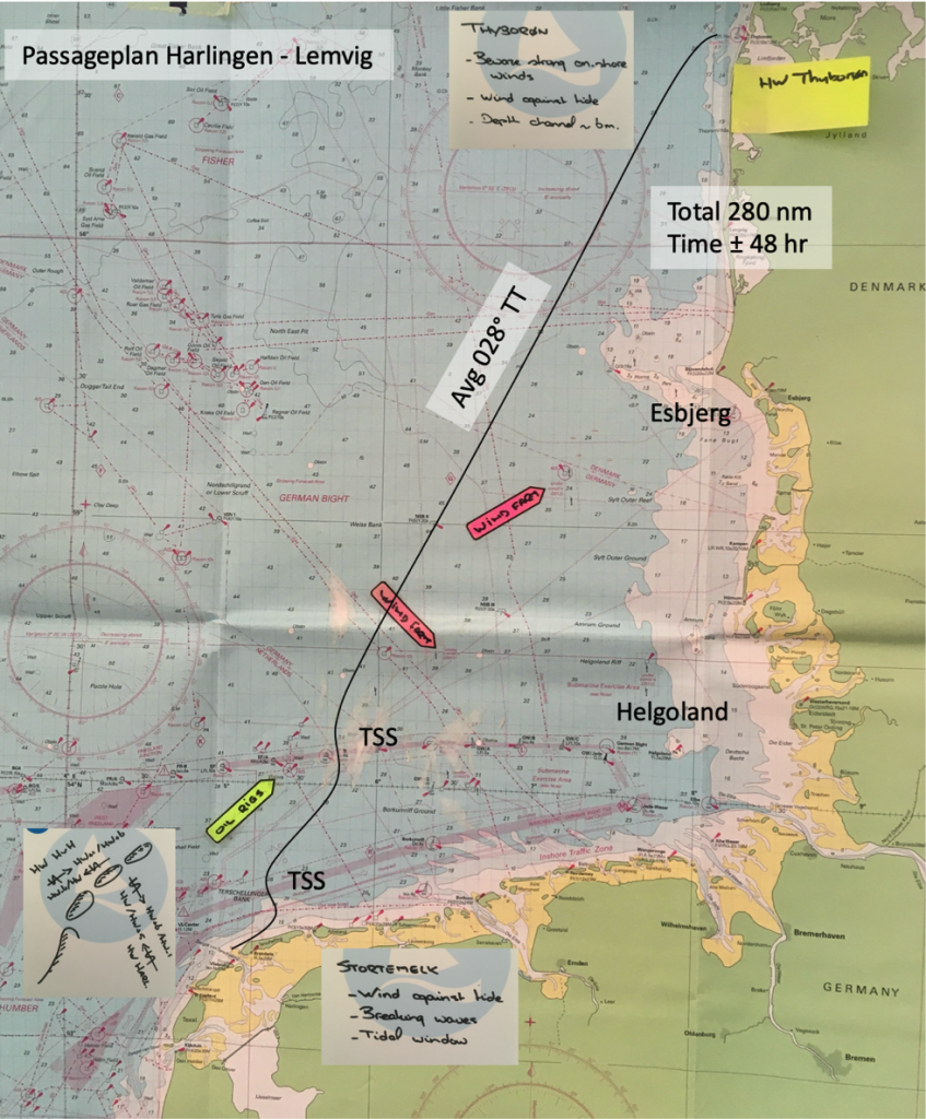
When planning a trip, the general part can be done well in advance. Once the departure harbour is established and you have an idea where to go, you can start collecting information. Sources for this information include charts (overview and detailed), almanacs, pilot books and of course blogs and experience of other sailors. Calculating with a conservative passage speed, you have a rough idea about the duration of the trip.
Some parts of the passage might have ‘external’ constraints, such as locks, bars, tidal windows, TSS’s or windfarms. You might have a few ‘personal’ constraints, such as aiming to arrive in daylight or not leaving in the middle of the night. My personal preference is to arrive upwind – uptide of my destination, to make the last hours of a passage that much easier.
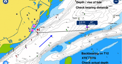
It is useful to identify these constraints at an early stage, without going into too much detail. You can mark them on an overview chart using Post-it arrows. Tidal vectors can be referenced to the HW times at the port of departure and arrival. During longer offshore passages tides even out and I tend not to correct for this. This generic information can be updated once your departure date is known.
Marking shallows, TSS’s, windfarms, oilrigs etcetera on the charts helps in forming a clear picture of the intended trip and its hazards.
A next step is to look at alternatives. Can you return to our departure harbour, what are other (all weather, all tides) ports of refuge that can be used if your plan doesn’t work out? If you are planning for a ‘constrained’ destination, it helps to have an open diversion harbour within reach.
In this phase of planning you don’t need the actual weather information, you could prepare several options and later decide which one aligns best with actual weather, interests, mood etcetera.
Several days before the planned departure date start looking at the weather development. One of the sources for weather-charts is Bracknell. Their charts include pressure systems, isobars and frontal systems. The NOAA charts additionally indicate wind strength and storm/gale warnings.
Another source of weather information is Numerical Weather Prediction output, so-called GRIB files. GRIB’s are available from a variety of Met-offices, and differ in resolution (spacing between the grid points), detail and duration. Hi-resolution GRIB’s normally have a shorter duration (to limit the amount of data). The GFS (global forecast system) model is well known, but others are also widely available. A GRIB viewer lets you advance through time (7 – 10 days ahead) and displays weather data on a chart. You can assess the wind direction/strength, waves etc you will encounter on your trip.
Routing software makes this process easier, but we’ll leave that subject for later discussion.
By combining the overview chart (including constraints) and the weather forecast you can decide which departure date/time fits best and creates the most comfortable ‘window of opportunity’ for your trip.
Albert de Nijs, Dutch Offshore Sailing Academy