RYA-tips #18 – The 4 essential elements of the BBC Shipping forecast
Zeilen is een combinatie van wetenschap en kunst. En voor wie daar meer over wilt weten schrijft Albert De Nijs, instructeur bij de De Zeezeilers van Marken wekelijks een rubriek met tips&trics van de Royal Yachting Association.

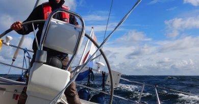
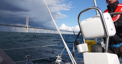
When looking at the weather we can take guidance from the BBC Shipping forecast. This forecast has been an institute among mariners for over 150 years. It contains 4 parameters that are important for us, wind, sea-state, weather and visibility. It also issues gale warnings (wind force 8 Bft or higher). This is exactly the information we are looking for when preparing a passage, or when assessing whether a planned trip is feasible.
With some practice you can interpret a weather chart (Bracknell) and make your own prediction for these four important meteorological conditions.
Wind is the primary parameter. From the isobars on the weather chart (their direction and spacing between them) you can estimate the wind direction and speed (you find the geostrophic wind which needs to be corrected for sea level).
Wind is the driving force for wind waves. Given enough depth, fetch and time, wind-strength has a direct relation to wave height (See article #7: Sea-state, or the state of the Sea – 15 June 2019).
Swell, waves migrated away from a wind-field, are more difficult to predict. After a prolonged strong Westerly gale, you can expect a big swell. A light Easterly wind might generate some wind waves, but the swell will be paramount.
The sea state in the shipping forecast includes both wind-waves and swell.
Weather and visibility hang closely together with the weather systems you find on the charts and the origin of the transported airmass. For example, in the warm sector of a depression you can expect low clouds, rain and poor visibility. After the passage of the cold front, the wind will veer, clouds will lift, chance of squalls, good visibility etcetera. Cold air arriving over relative warm water can easily produce wintery showers, while warm air arriving over cold water gives a chance of fog etcetera.
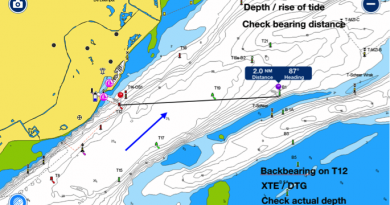
You can practice analyzing weather charts by comparing the Bracknell chart with the BBC Shipping Forecast. Just select a forecast area on the chart, try to find wind direction and speed, wave height (sea state), weather and visibility and check that against the Shipping Forecast.
Producing weather charts (analysis and forecasts) is work for specialists, but interpreting the charts is a perfect job for sailors!
Albert de Nijs, Dutch Offshore Sailing Academy